The illuminator of history
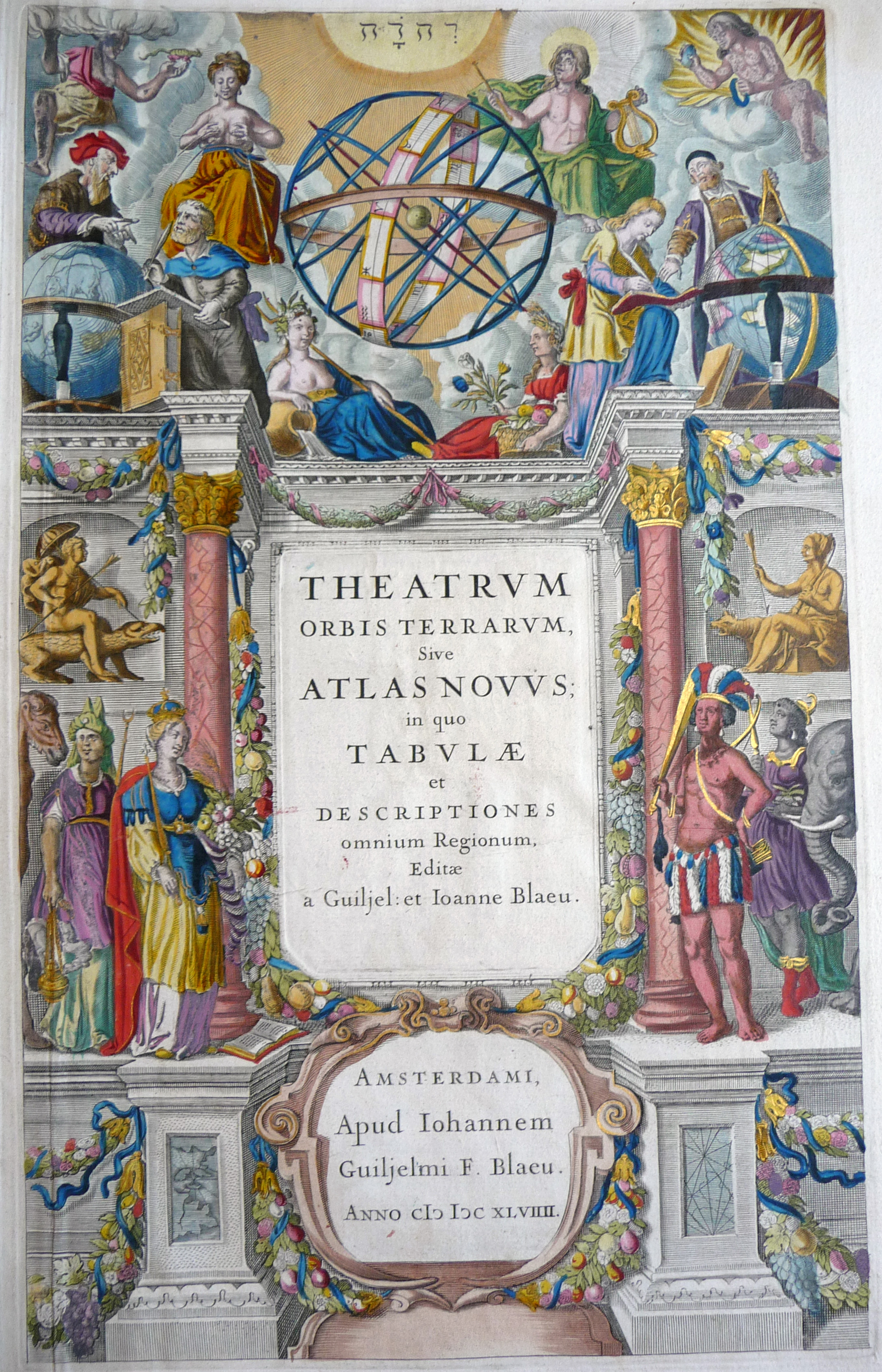
Theatrum orbis terrarum, sive, Atlas novus (Theatre of the world, or, A new atlas), edited by Willem Janszoon Blaeu and Joan Blaeu. Printed in Amsterdam by Joan Blaeu, 1649–1655.
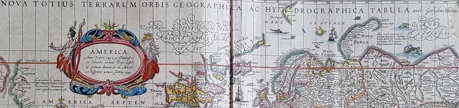
Lower Library, D.41.6–11
The 17th century was a Golden Age for Amsterdam. As a centre for trade it had become one of the wealthiest cities in the world, while at the same time its comparative religious tolerance and free press attracted an influx of European intellectuals, merchants and printers. The city was fertile ground for the creation of the most magnificent maps of the period.
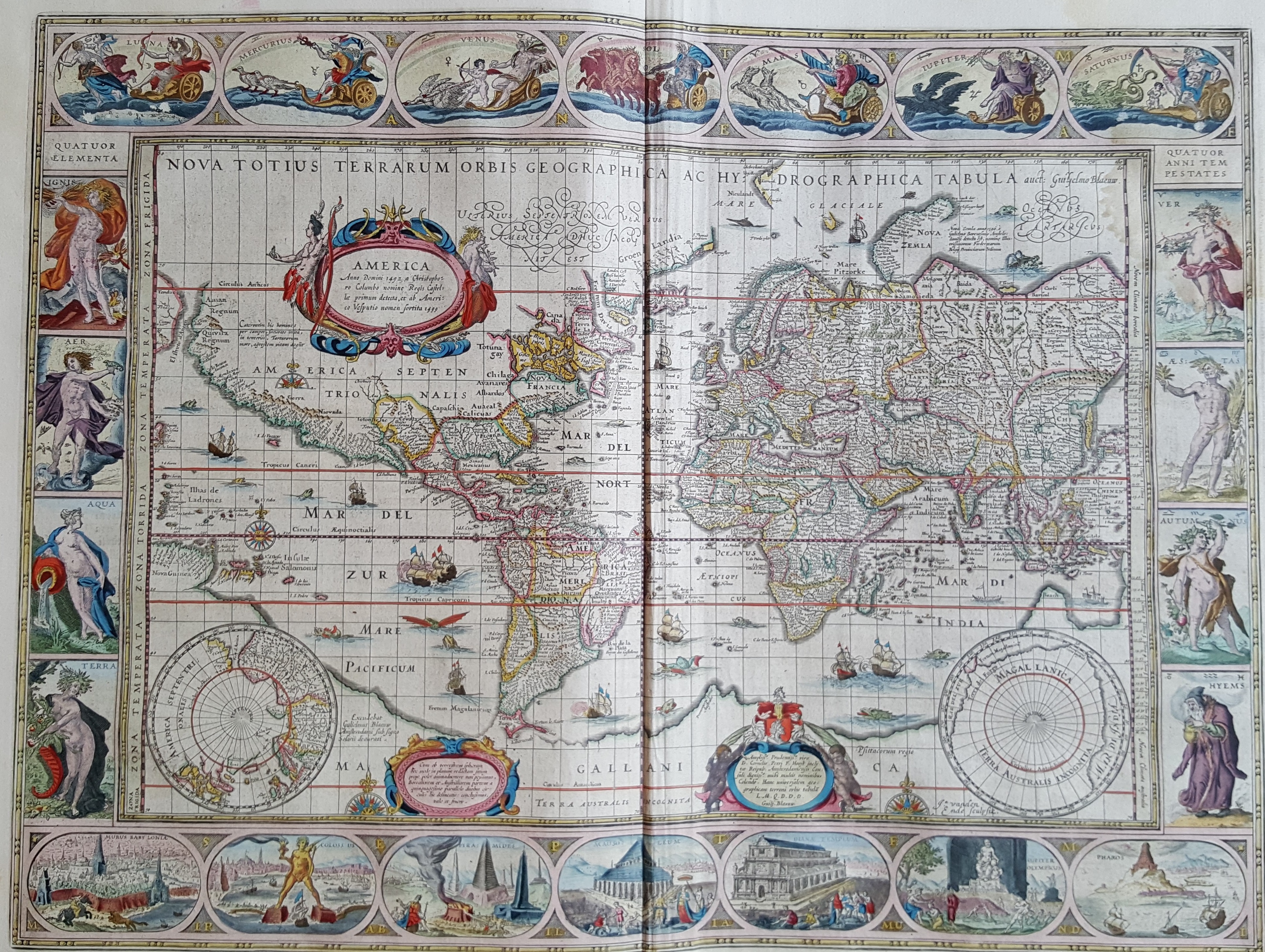
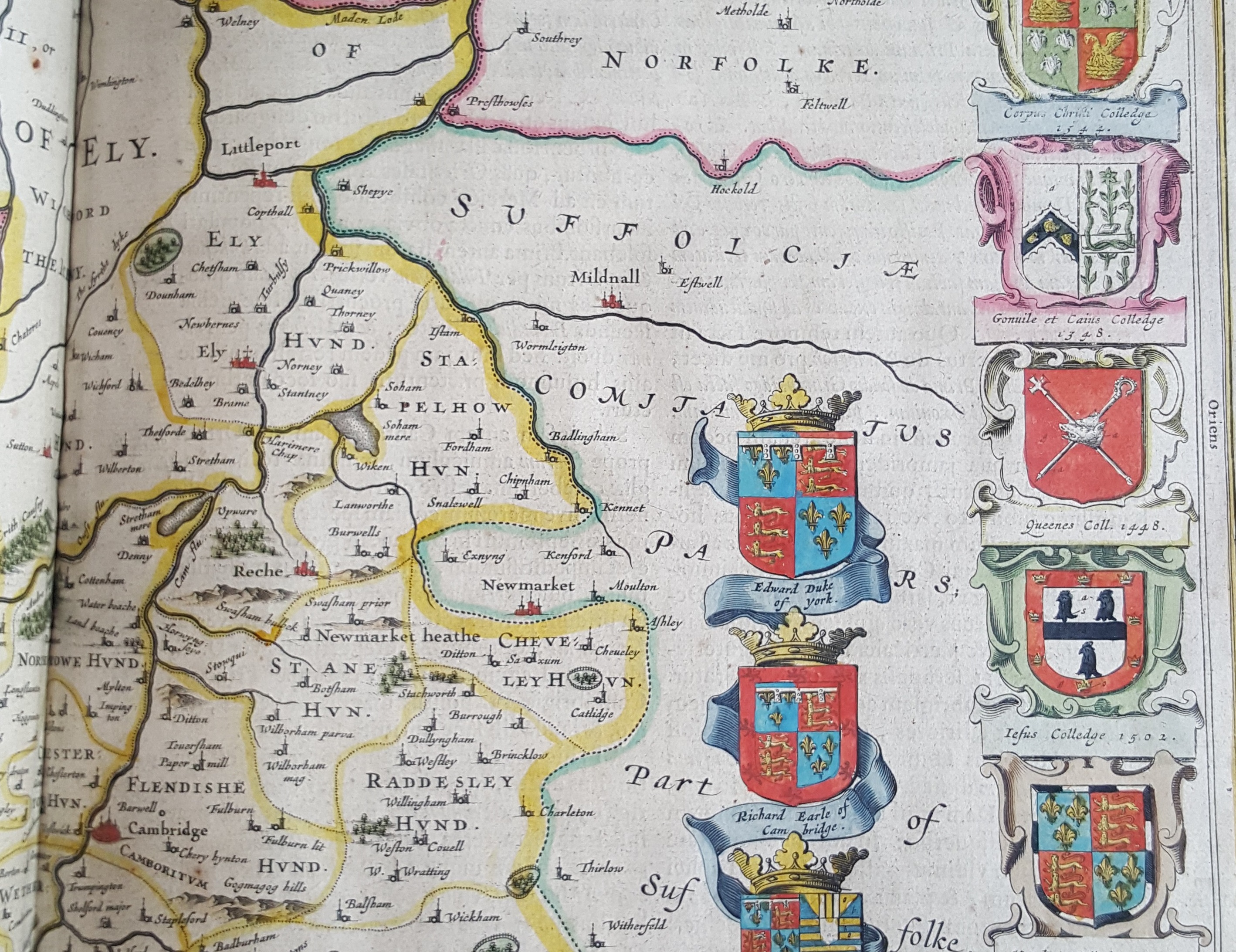
In 1608 the Amsterdam globe-maker Willem Janszoon Blaeu (1571–1638) began to produce wall maps, which were becoming symbols of status and intellectual curiosity for wealthy Dutch in the Age of Discovery. His proficiency led to his appointment as Hydrographer to the Dutch East India Company in 1633 (later superseded by his son Joan), gaining him access to the most up-to-date geographical information. In 1634 Blaeu announced plans for a multi-volume world atlas in Latin, French, German and Dutch editions: Theatrum orbis terrarum, or Atlas novus, which would include remastered, expanded and new maps. By the time of Willem's death only 2 volumes of the Atlas had been published, but under the direction of his sons the 6 volumes were completed in 1655. It is this version, with just over 400 maps, that we hold at Caius.
The influence of Blaeu's embellished version of the Mercator projection map (above) was widespread and it was much-emulated by his rivals. The refined engraving and colouring were trademarks of the Blaeu output, as were the elaborate calligraphy, heraldic detail, and cartouches that were often tailored to the featured location. This was no-expense-spared mapmaking. These atlases were designed to satisfy the wealthy collector's appetite for art and exploration.
Another reason for all this detail was the historical aim of the atlas. For the Blaeus, geography was 'the heart and illuminator of history – for no exploit great or small is performed without location'*. Each map is accompanied by several pages of physical description and history of the area, often including further illustrations.
In 1662, Joan published an even larger work, the Atlas major, in 11 volumes (later non-Latin editions in 9–12 volumes). Further parts were planned, detailing the oceans and skies, but a studio fire in 1672 halted business and Joan died the next year. By the end of the century Amsterdam was in decline and the Golden Age of Dutch cartography was over.
Caius holds all 6 volumes of Atlas novus, in Latin, bound in calf and enhanced by gold ornaments and edges. Each volume has an engraved, illustrated title page embellished with gold-leaf, and all title-pages, illustrations and folded maps are hand-coloured.
A hand-painted coat-of-arms on the flyleaf verso of volume 1 names William Buggin as the owner. He was admitted to Caius in 1652 and became a Junior Fellow in 1656. The six volumes were presented by Buggin to the Library on July 6th 1659.
* Translation from Peter van der Krogt in: Joan Blaeu (2005). Atlas maior of 1665. Cologne: Taschen Verlag. We hold this facsimile reprint in the Upper Library (Ref 912 B).